From Space to Field: Using Earth Observation in AgriFood in the UK and Africa

Earth Observation (EO) - including satellite data and drone imaging - is used to support innovation across agriculture and food production, from monitoring weather conditions and improving in-field decision making to managing supply chains.
African countries are now developing world-leading expertise in these space technologies. Collaboration between partners in the UK and Africa provides new innovation opportunities to address the challenges facing African AgriFood systems.
Earth Observation – in a nutshell
EO provides information on land, marine environments and the atmosphere by using satellite imaging or remote sensing technologies (EUSPA). Drones, for example, can be operated remotely or manually, taking detailed images of the Earth to provide information and inform decision-making on a local scale. Satellites provide EO imagery on a global scale taking imagery of the same location daily in some cases (Planet). EO data is collected across the electromagnetic spectrum from visible light through infrared to radar, providing different types of insights on the planet.
Satellite technology
The satellites orbiting the earth are owned by businesses and governments, and in addition to EO, they provide telecommunications and geopositioning (estimating the geographic positions of objects) services to the world. Satellites are disrupting telecommunications, providing connectivity to remote locations unserved by terrestrial services, which is especially important to the agri-tech sector. In addition, satellites have revolutionised geopositioning, which has brought huge benefits to society in terms of navigation and supports autonomous farming practices. The growth in satellite technology, and its increasingly cooperative usage, can greatly benefit the AgriFood sector, as explained further below.
How EO is used in agriculture and food production
EO technology has brought numerous benefits to farmers and growers. Benefits include forecasting weather, detecting and controlling pests and disease, understanding water and nutrient status, planning crop nutrition programmes, informing in-season irrigation, livestock monitoring, predicting yields, and estimating harvest timing (Agriculture and Horticulture Development Board).
Satellite imagery has also shone a light on how climate change is impacting agriculture, including in Africa (NASA). Whilst these findings are not directly used as a service by farmers, they enable NGOs and Governments to identify and plan interventions for environmental threats to food production as well as potential pest and disease outbreaks. This builds resilience and supports adaptation to climate-related environmental hazards. These findings also enable insurers and banks to assess the risk profiles of smallholders and provide financial products at affordable interest rates.
Four key ways space technologies can address AgriFood challenges
The UK Space Agency’s 2018 report into the relationship between space and AgriFood summarises four key ways space technologies can address AgriFood challenges:
- Increase production – EO improves the accuracy and relevance of decision support tools and affordability of credit products.
- Improve supply chain efficiency to reduce losses – EO enables supply chain optimisation.
- Sustainable management of environmental resources and supply chain traceability – EO improves the range of decision support tools for resource management and traceability.
- Resilience to climate change – EO improves the accuracy of early warning systems and affordability of insurance.
Current status of EO in UK agriculture
Satellites and drones are key enabling technologies for the precision agriculture systems widely deployed in the UK. They enable numerous data-driven innovations that improve the efficiency, sustainability and productivity of UK farming, including variable rate application of fertilisers/pesticides and ‘controlled traffic farming’ (AHDB). The UK landscape is developing quickly, with organisations of all sizes from large multinationals to individual farmers using EO to optimise their supply chains and operations.
Unilever is using AI and satellite imagery to improve traceability and transparency for the sustainability of their supply chains. Barfoots of Botley uses the world’s most sophisticated satellite observation fleet, managed under the Copernicus programme, to identify whether farmlands are lush or dry and if crop yields are rich or poor, plus revealing how farming is impacting natural habitats.
Mantle Labs are using scans of the earth to create the world’s first agriculture fintech platform which provides a complete risk assessment solution for banks and insurance companies to manage their agriculture portfolios.
On a more local level, CropWise have created a mobile app that alerts farmers to changes in crop and weather conditions based on satellite data. They are working with the UK Space Agency to push their innovation forward and reach more farmers.
UKSRI overcomes traditional limitations of weather forecasting by using satellite data to provide accurate longer-term forecasts that help farmers plan to avoid overproduction and waste. The SAR crop index has gathered data on crop growth using EO which, combined with weather forecasting, provides UK arable farmers with valuable crop data and projections.
Other UK companies focus on drones. SOYL uses drone technology to take images of crops for further analysis, Drone Ag has crop spraying capability, and Outfield combines AI with drone imaging to predict fruit harvests and manage the lifecycle of orchards.
Satellite technologies also extend to livestock farming. Scotland’s Rural College (SRUC) are exploring using satellites and AI to develop virtual fencing for cattle and technology to manage livestock by, for example, nudging them away from danger using collars and noise.
These technologies are also being deployed in aquaculture including for new site identification, diversification with new species selection and for enhanced production of products like seaweed. Satellite imagery can also provide early warnings and monitoring for harmful algal blooms and other water quality issues (Fish Farming Expert).
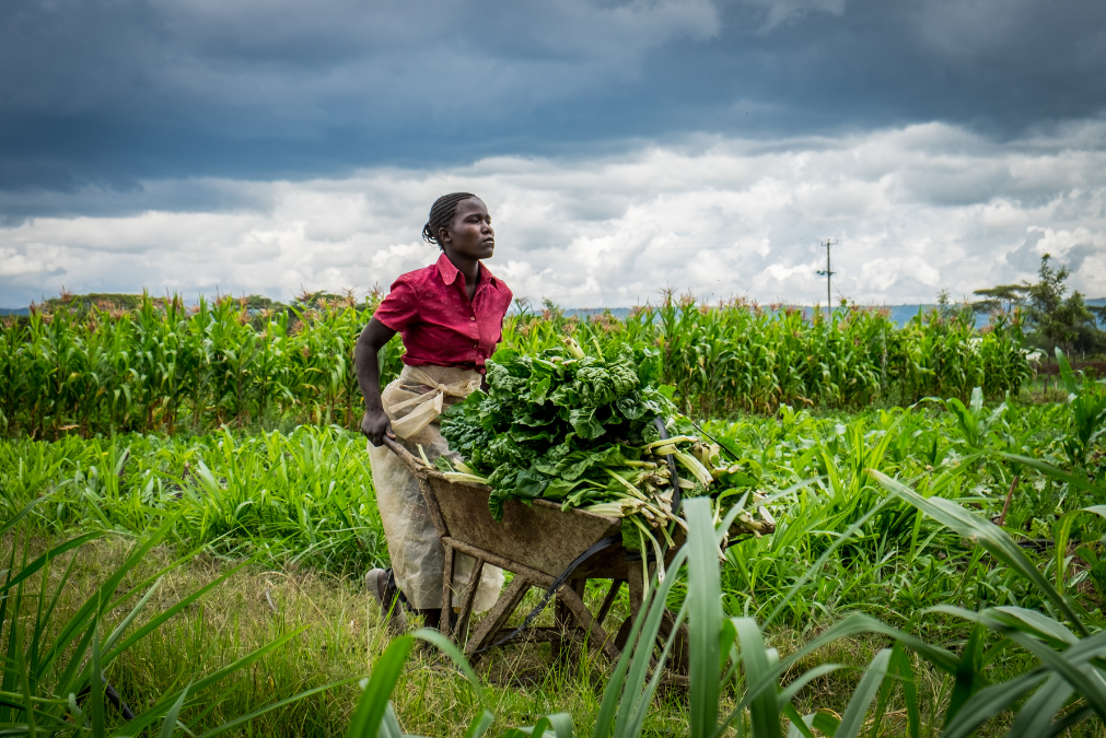
Current status of EO in African agriculture
The UK Space Agency categorises EO solutions for developing countries into three thematic areas: decision support tools, early warning systems, and insurance and credit products. Some examples of these solutions are listed below.
International organisations and businesses are making investments in satellites in Africa. Mondelez is mapping the cocoa farms covered by a sustainability scheme using satellite technology, with the goal of supporting smallholders’ climate resilience, eliminating deforestation and increasing forest cover associated with their supply chain in numerous West African countries.
African businesses and governments are looking to take a lead role in the expansion of satellite technologies this century. South African aerospace startup Dragonfly Aerospace recently launched the world’s first satellite constellation dedicated specifically to agriculture, with plans to launch another six satellites by 2025.
The GroWise Project, funded by the European Space Agency, uses space technology to improve credit lending for African smallholders growing a number of staple crops. KORE is a precision agriculture service that combines EO with the expertise of agronomists to advise farmers on effective land-use.
The information gathered from EO brings many economic benefits for smallholders, including saving up to 10% annually on fertiliser and saving money on fuel costs for trips around the fields, according to Food for Afrika. EO information also enables insurers and banks to give smallholders access to financial products and services at reasonable prices.
Challenges and trends in Africa
The ever-increasing threat of climate change is negatively impacting African agriculture. EO will play a key role in identifying these impacts before they emerge, enabling governments, businesses and the international community to respond more effectively. For example, University of Reading research is providing reliable information on rainfall patterns for African farmers.
The markets for EO commercial data and satellite services for agriculture are expected to double in size to over £800m between 2019 and 2029 (Euroconsult). Precision agriculture is expected to be at the forefront of this growth, and will be vital for African agriculture in the face of growing climate change impacts.
The push towards greater democratisation of satellite data may also benefit the African agricultural sector. Satellite systems and online databases like Lacuna Space, Planet Labs and Copernicus have the potential for commercial business models that could enable access for huge numbers of farmers (Frontiers). This may manifest in access to both raw data and insights, whereby data is offered up analysis-ready with less requirement for specialist technology or expertise. For example, Earth Blox provides processing blocks to lower the barriers to gathering insights from geospatial data.
Technological developments in areas like big data, miniaturisation, microchips, cloud computing, the Internet of Things, deep learning and artificial intelligence are likely to further accelerate. International organisations like the Group on Earth Observation will play a key role in ensuring that global developments in EO technologies are accessible and contribute to sustainability and poverty alleviation in Africa.
Funding opportunities
There are numerous EO focused funding calls currently providing opportunities for innovation development and collaboration in the UK, Europe and Africa:
- ESA Business Applications Programme (open call)
- Sustainable Synergies: Interconnect Systems for Positive Impacts (feasibility studies)
- Finance for a Green Transition (feasibility studies)
- Digitising Water Resilience- Acting on Water Stress in Basins (non-competitive thematic call)
- GSMA Innovation Fund for Climate Resilience and Adaptation
Get involved
If you are interested in projects in this area, would like support to make connections to solve a challenge, fast-track your innovation or apply for funding together, get in touch. We would particularly like to hear from large African AgriFood companies who have a challenge that could be helped by space technology.
Email us at gcrf.agrifood@ktn-uk.org to discuss your innovation or idea.
Related programme
AgriFood Africa Connect
Innovate UK AgriFood Africa Connect brought innovative people and organisations across the UK and Africa together to develop solutions for the sustainable management of AgriFood systems in Africa.